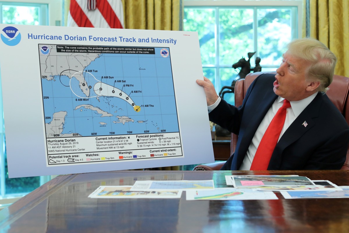
Donald Trump shows fake Hurricane Dorian map to validate his incorrect tweet that storm threatened Alabama
- Trump points to map with black loop extending hurricane’s path
- President made baseless claim that Alabama would be affected
To the annals of American political scandal, we must now add Sharpiegate.
In the Oval Office at lunchtime on Wednesday, US President Donald Trump held a briefing on Hurricane Dorian.
At one point, the president held up a National Hurricane Centre (NHC) map from August 29, displaying the hurricane’s track and intensity.
Bizarrely, someone had apparently used a Sharpie, a kind of marker pen, to add a black loop falsely extending the hurricane’s path from Florida to Alabama.
It was apparently a belated effort to justify Trump’s previous baseless claim that the latter state could be affected.
The ham-fisted, homespun addition triggered uproar on social media and a frenzy of speculation over whether the president himself, or perhaps some lackey eager to impress, was responsible.