Explainer | Why was Hong Kong pelted with torrential rain on Saturday and is global warming to blame?
- Observatory says that by 4pm, accumulated 400mm of rainfall recorded in parts of Tseung Kwan O and more than 200mm had fallen in eastern part of city
- The Post speaks with meteorologists about whether the intense rainfall is unusual for this time of year and why it is happening
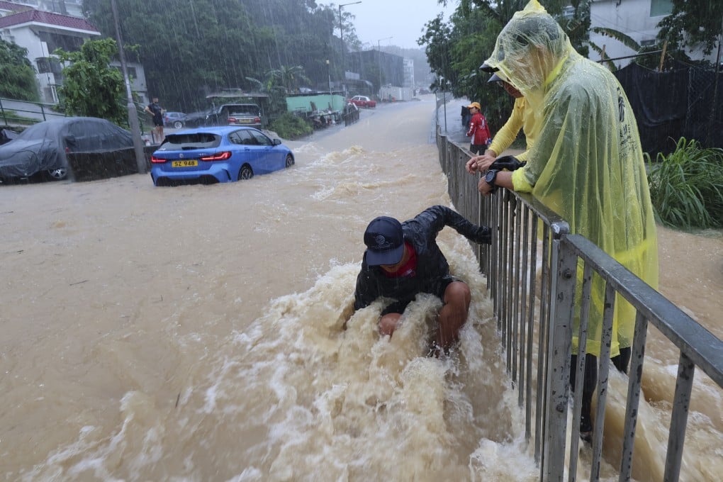
Hong Kong was hit on Saturday with intense rain and flooding in areas including Tseung Kwan O, Shau Kei Wan and Clear Water Bay, creating scenes that reminded some residents of the “once-in-500-years” storm that struck the city last September.
The Observatory said that by 4pm, an accumulated 400mm of rainfall had been recorded in parts of Tseung Kwan O, and more than 200mm had fallen in the eastern part of the city.

1. Is Saturday’s rainstorm an extreme event?
The Observatory said Saturday’s rainstorm was mainly triggered by a trough of low pressure and upper-air disturbances in the region. The weather system brought heavy showers and squally thunderstorms to the vicinity of the Pearl River Delta, it added.
Lee Tsz-cheung, a senior scientific officer at the Observatory, said the rainfall on Saturday was uncommon and fell in an “extremely uneven” way.
He attributed the varying precipitation in different parts of the city to the low speed at which the rain clouds moved.
Leung Wing-mo, a former assistant director of the Observatory, said it was unusual to record more than 200mm of rainfall in a day in May.