Israel-Gaza war: Chinese satellites detail scale of destruction in besieged Palestinian territory
- Analysis using remote sensing technology from Wuhan University puts the level of damage at about 60 per cent
- Researchers from the university tracked the conflict’s impact since mid-October
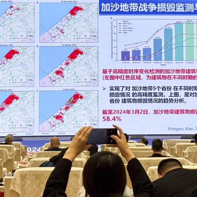
“Comparative analysis shows that as of March 2, 2024, 58.4 per cent of buildings and 34.1 per cent of farmland in the Gaza Strip were damaged,” Li Deren, a professor of remote sensing at Wuhan University, told the China Space Conference in the central Chinese city of Wuhan on Wednesday.

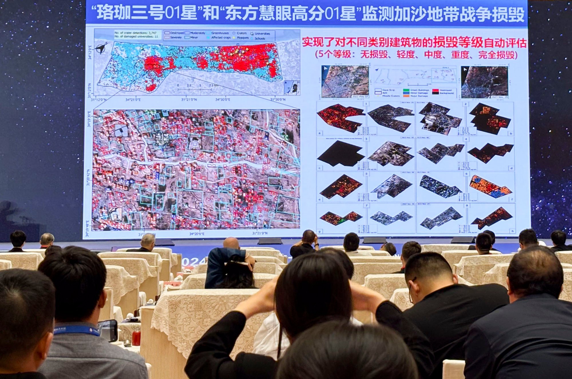
The estimate was based on comparison of observations by the university’s Luojia-3 and Dongfang Huiyan Gaofen01 satellites taken since October 17, before Israeli forces invaded the Gaza Strip.
Using advanced automated recognition algorithms, the satellites detected and assessed damage to various types of structures including schools, universities, hospitals, and places of worship. They then categorised the destruction.
Li said that before November 10, 18.7 per cent of buildings in Gaza had been damaged. This increased to 32.6 per cent by November 29, and 56 per cent by January 22, before stabilising at 58.4 per cent by March.
According to researchers at the City University of New York and Oregon State University, 55.9 per cent of buildings in Gaza, or about 160,800 structures, had been damaged or destroyed by Israeli bombings as of November 29.
The BBC reported on December 2 that about 100,000 buildings had been destroyed.
The Chinese researchers were also able to identify the location, size, and number of missile craters over time, detecting a total of 3,747 craters in the Gaza region by March 2, while Gaza City sustained twice the damage compared to Deir al Balah City, on the strip’s central coast.
At 365 sq km (140 square miles), the Gaza Strip is roughly the size of Nagasaki, the Japanese city targeted by a US atomic bomb in 1945. In that blast, about 39 per cent of the municipality’s buildings were damaged or destroyed, according to the city – a level that has been surpassed in Gaza.
The Chinese estimate helps fill in some of the holes in knowledge about the extent of damage in Gaza, with surveys on the ground not possible.
Google satellite imagery, for example, does not reveal the level of destruction to Gaza, with streets and buildings in the city appearing to be intact on its maps.
China has some of the world’s biggest Earth observation networks and Li said its space-based observations were growing in influence because of the data’s “broad scope, timeliness, and geopolitical independence”.
“Over the past decade, China’s remote sensing satellites have undergone transformative development, advancing from experimental stages to operational and commercial use,” Li told the conference.
“Further advancements are expected with more frequent imaging, larger coverage areas, and faster data transmission.”


