China makes ‘world’s largest satellite image database’ to train AI better
- New FAIR1M database is tens or hundreds of times larger than previous data sets, according to Chinese Academy of Sciences
- Database of 15,000 high-definition images with 1 million labelled ‘scenes’ can aid AI’s accuracy, such as enabling it to identify not only a plane but its model
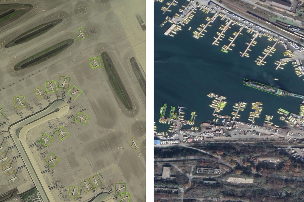
The fine-grained object recognition in the high-resolution remote sensing imagery (FAIR1M) database is tens or even hundreds of times larger than similar data sets used in other countries, it said.
Professor Fu Kun, a lead scientist on the FAIR1M project with the academy’s Aerospace Information Research Institute in Beijing, said the relatively small size of databases for artificial intelligence (AI) training in satellite image recognition had affected accuracy in real-life applications.

“A challenging and excellent data set can accelerate the development of the field,” he and colleagues said in a paper about their work, posted on arxiv.org in March.
Militaries have used spy satellites to study objects of interest since the 1960s. Assessment was initially done manually by trained professionals, before computers helped to speed up the process. Military image recognition technology was mostly classified, and usually limited to a small range of sensitive objects.
In recent years, rapid development of AI technology has enabled civilians to obtain valuable information from commercial satellite images.
Counting the number of cargo trucks on the roads of a city or even a country, for instance, could provide insight into economic activity, transport and infrastructure.