Ancient Chinese maps debunk Beijing's sea claims, says Philippine judge
A judge has laid out a case for the Philippines' claim over disputed islands, citing analysis of old maps and calling Beijing's line that extends into Southeast Asia a 'gigantic historical fraud'.
A judge has laid out a case for the Philippines' claim over disputed islands, citing his analysis of old maps and calling Beijing's nine-dash line that extends into Southeast Asia a "gigantic historical fraud".
Senior Supreme Court Judge Antonio Carpio challenged Beijing's claim to 90 per cent of the 3.5 million sq km resource-rich South China Sea, part of which is also claimed by Manila. The Philippines has filed a case with the United Nations challenging Beijing's claims.
Meanwhile, tensions between China and Vietnam have escalated in recent weeks following Beijing's dispatch of an oil rig to waters surrounding another contested island group, the Paracels.
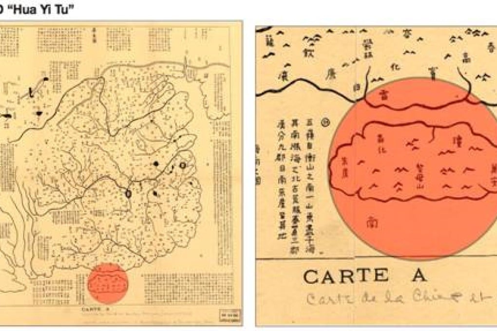
Carpio used a recent lecture to present 72 ancient maps - 15 of them of Chinese origin. All supposedly showed China's southern border ending at Hainan.