Where will the government rezone for new housing sites?
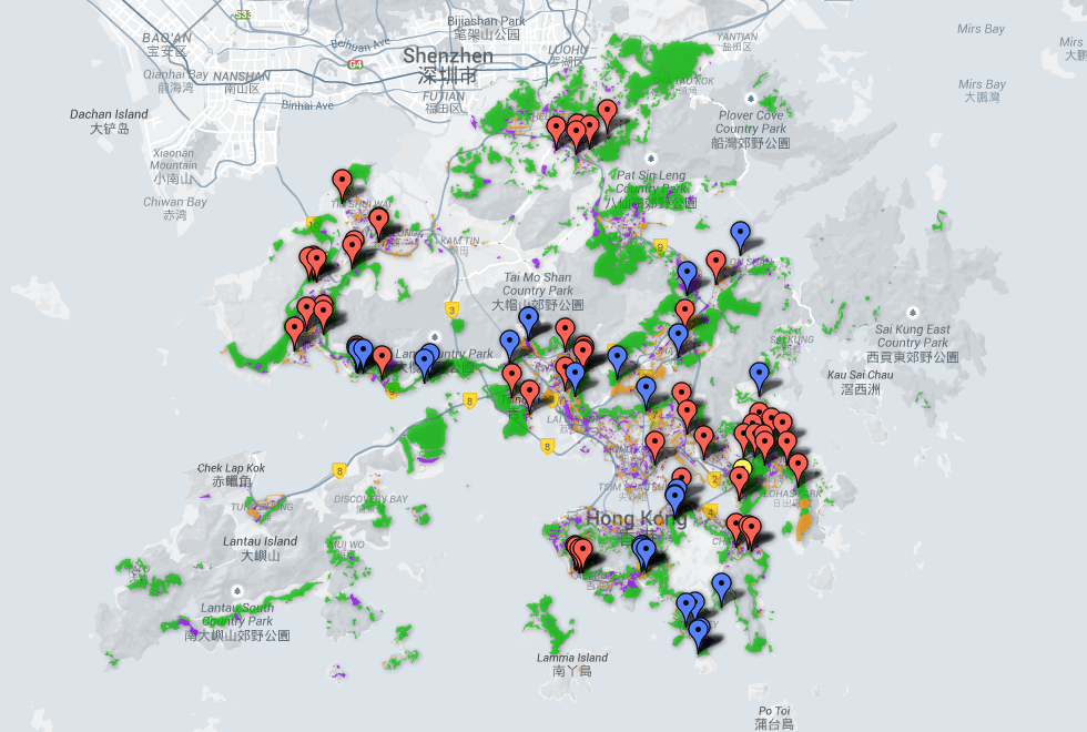
The government plans to rezone 150 sites of various types of usage to increase residential land. We selected 79 sites that required rezoning and mapped them against the backdrop of current zonings.

Based on a Legco document released on January 2, 2015, we mapped 79 housing sites that need to be rezoned from open space, green belt and government, institutional and community usage types.
In the document, the locations of those sites are approximate, and therefore the map is a rough representation of the true location based solely on the address provided and current zonings.
The base map was created using zonings provided on the Statutory Planning Portal website.

Post
Advertisement