
Google’s ‘time machine’ maps its way into the past
New function shows old images as Trekker backpack with panoramic camera system adds 23 new city locations to tech giant's Street View
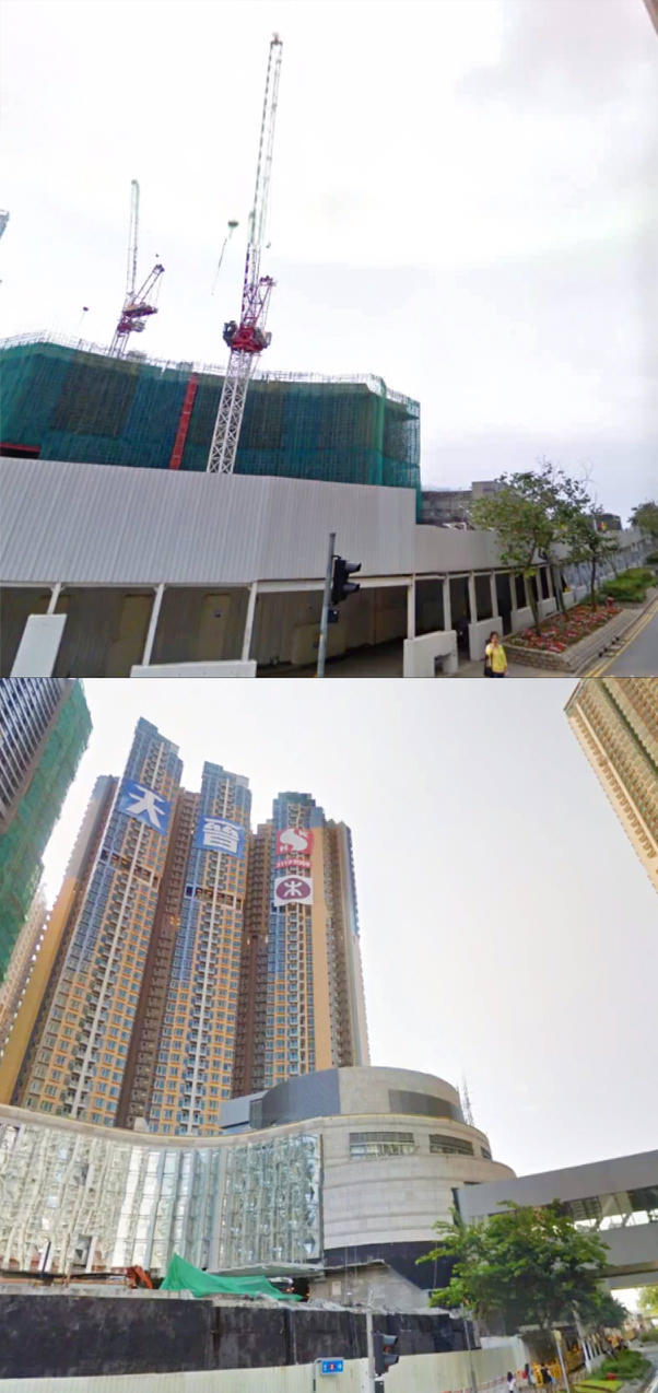
Remember how West Kowloon looked without the high-speed railway construction going on? A new function on Google Maps may help refresh your memory.
The technology giant launched a new worldwide upgrade of its maps yesterday, allowing users to not only see what streets look like today, but also what they used to look like.
In addition, 23 new locations - images of 14 hiking trails, four reservoirs, three outlying islands and two special areas - have also been added, made possible by a new backpack camera device brought to Hong Kong in August last year.
Six months of trekking around the city by foot with the Trekker - an 18-kilogram backpack with a camera system which can take panoramic views by stitching 15 photos together - added images of previously unreachable spots in the city.
Google took its first street views in Hong Kong in 2010 - before the Kai Tak Cruise Terminal, developments on the West Kowloon waterfront and changes to shopfronts across the city.
There are now street views of 170 locations, streets or areas in Hong Kong.
Some locations - including a hotel on Salisbury Road, a mall in Tsim Sha Tsui and an MTR property in Tseung Kwan O - can now show old images with the "time machine" function. Other locations are to follow.
Calling it a "digital time capsule of the world", images collected since the launch of the first Street View in 2007 now "serve as a digital timeline of recent history, like the reconstruction after the devastating 2011 earthquake and tsunami in Onagawa, Japan," wrote Google Street View product manager Vinay Shet on Google's official blog.
Apart from showing old images, the number of Hong Kong's street views have increased, thanks to the Trekker.
"The Trekker has allowed us to get to places which could only be reached on foot," said Cynthia Wei, programme manager of Google Street View in Greater China and Southeast Asia.
Wei added that Google was looking for partners in the city, who can apply to take the Trekker to capture more local spots.
A set of photos are taken every 2.5 seconds by the Trekker, creating enough 360-degree images to form a "street view". Since August last year, Hong Kong has had its own trekker and operator Raf Ho, who has covered 250 kilometres around the city.
New spots added include hiking trails like the Dragon's Back, with views of Big Wave Bay, Stanley and Tai Tam; four reservoirs including Pokfulam Reservoir and Shing Mun Reservoir; outlying islands Lamma, Cheung Chau and Peng Chau, and special locations Stanley Market and Beas River Riding School.
Apart from the Trekker, Google also uses cars, trikes and trolleys to capture street views.
Street views of 56 countries and more than 3,000 cities are now viewable on Google Maps.

